

UAV Drone
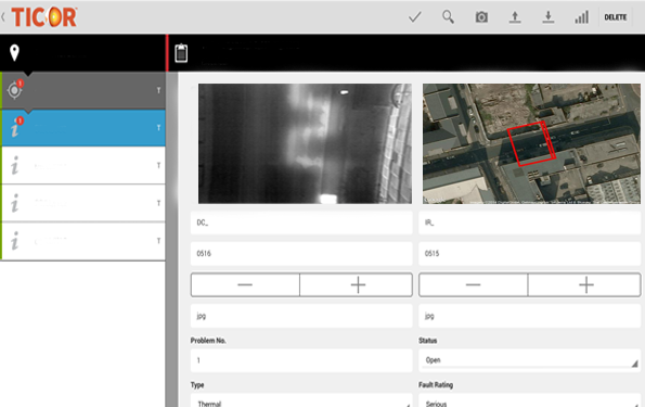
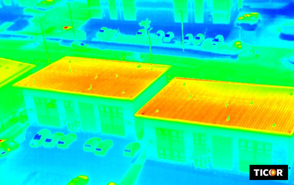
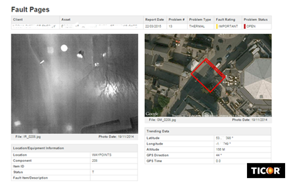
The use of purpose built UAV Drone carrying our high resolution 640×512 Thermal Imaging detector offers a unique perspective on applications such as underground pipework, trunk main, heating pipes and even high rise multi level buildings.
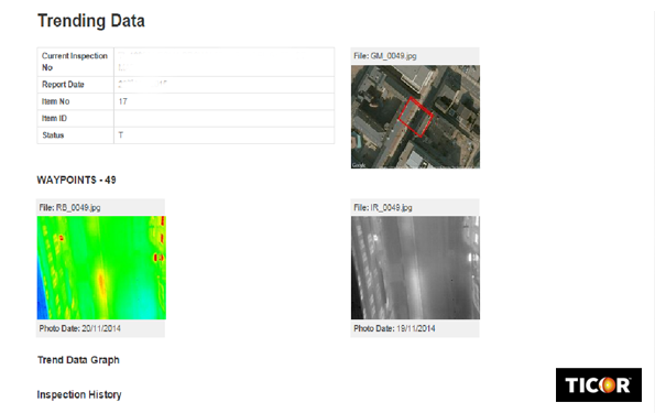
The UAV drone can be programmed to fly specific routes utilising GPS positioning all the while capturing high resolution thermal and visual images. These images are recorded with Latitude, Longitude, Altitude, GPS Direction and GPS Time. All of these images, regardless of fault are efficiently imported into our WEBCOR™ system which then efficiently organises this data. Assessment is carried out to extract potential problems and the exact positioning is applied allowing ground teams to mobilise and investigate the anomaly. This procedure eliminates costly large scale investigative actions by pin-pointing areas of concern.
